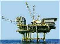
 The Outer Continental Shelf (OCS) is a big source of oil and gas. All offshore oil and gas wells supply approximately 25 % of the country’s natural gas production and approximately 30 % of total domestic oil production. The Department of the Interior (DOI) Mineral Management Service (MMS) estimates of oil and gas resources in undiscovered fields on the OCS total 76 billion barrels of oil and 406.1 trillion cubic feet of gas. These volumes represent about 60 percent of the oil and 41 percent of the natural gas resources estimated to be contained in remaining undiscovered fields in the United States.
The OCS Lands Act requires the DOI to prepare a 5-year program that specifies the size, timing and location of areas to be assessed for Federal offshore natural gas and oil leasing. It is the role of DOI to ensure that the U.S. government receives fair market value for acreage made available for leasing and that any oil and gas activities conserve resources, operate safely, and take maximum steps to protect the environment. OCS oil and gas lease sales are held on an area-wide basis with annual sales in the Central and Western Gulf of Mexico with less frequent sales held in the Eastern Gulf of Mexico and offshore Alaska. The program operates along all the coasts of the U.S. - with oil and gas production occurring on the Gulf of Mexico, Pacific and Alaska OCS.
The term United Nations Convention on Law of the Sea (UNCLOS, also called simply the Law of the Sea or LOS) provided new universal legal controls for the management of marine natural resources and the control of pollution. LOS opened for signature - December 10, 1982 and entered into force - November 16, 1994. The U.S. has signed but not codified the treaty. The Third United Nations Conference on Law of the Sea (UNCLOS III) set the limit of various areas, measured from a carefully defined baseline, as follows:
Internal waters
Covers all water and waterways on the landward side of the baseline. Foreign vessels have no right of passage within internal waters.
Territorial waters
Out to 12 nautical miles from the baseline, the coastal state is free to set laws, regulate any use, and use any resource.
Contiguous zone
Beyond the 12 nautical mile limit there was a further 12 nautical miles or 24 nautical miles from the territorial sea baselines limit, the "contiguous zone", in which area a state could continue to enforce laws regarding activities such as smuggling or illegal immigration.
Exclusive economic zones
Extends 200 nautical miles from the baseline. Within this area, the coastal nation has sole exploitation rights over all natural resources.
Archipelagic waters
A baseline is drawn between the outermost points of the outermost islands. All waters inside this baseline is described as Archipelagic Waters and are included as part of the state's territory and territorial waters.
Landlocked states are given a right of access to and from the sea, without taxation of traffic through transit states.
(Sources: MMS, Wikipedia)
No comments:
Post a Comment